


The Z+F PROFILER® 9012 2D laser scanner, whose measuring system corresponds to the laser class 1, can be used without restrictions even in urban environments and has a vertical field of view of 360°.
With its scanning speed of more than 1 million points per second at a maximum speed of 200 profiles/sec. is the 2D laser measuring system of the profiles of both category.
Its characteristics allow to obtain short distances between the profiles even if the vehicle carrying it is proceeding at high speeds and can record and process even small objects thanks to the high density of points.
Signal processing from external devices is possible thanks to hardware-assisted pixel-by-pixel synchronization. As a result, the location and orientation of the scan data can be determined.
The advantages of choosing the Z+F PROFILER® 9012 series
The Z + F PROFILER® 9012 has a rotation speed of 200 rps (profiles /sec) and measures over 1 million points / sec.
With a maximum range of 119 m, the scanner is suitable for almost all mobile mapping applications.
The Z + F PROFILER, 9012, is dust and splash proof with protection class IP 54 and can be used at temperatures between -10 and +45 , C. In addition, laser class 1 allows its use in urban environments.
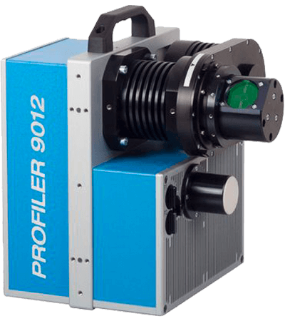
2D Laser scanner Z+F PROFILER® 9012 series
2D Laser scanner Z+F PROFILER® 9012 series:
Thanks to its optimised noise range within 1 - 5 m, the Z+F PROFILER® 9012A laser scanner 9012A is the optimal 2D scanner for close-range detection.
The Z+F PROFILER® is also available as the Z+F PROFILER model® 9012 M/A, which combines the marker mode and the high-precision embossing at close range.
Laser system
Noise range: 0.3 mm
2D Laser scanner Z+F PROFILER® 9012 series:
Displays up to 5 scan segments thanks to the Z+F PROFILER® 2d scanner marker mode 9012M.
The Z+F PROFILER® is also available as the Z+F PROFILER model® 9012 M/A, which combines the marker mode and the high-precision embossing at close range.
Laser system
Noise range: 0.3 mm
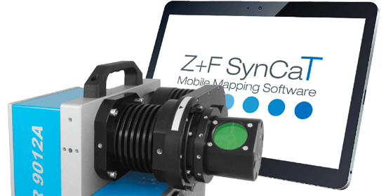
Mobile mapping software Z+F PROFILER® 9012 series
Synchronization, calibration and transformation are the main operations performed by the Z+F SynCaT® software.
Calibration: it will process the calibration parameters due to different system integrations (translation, rotary compensation between the coordinate systems of the navigation unit (trajectory) and the Z+F PROFILER laser scanner 9012).
Synchronization: the Z+F SynCaT® allows the synchronization of the Z+F PROFILER laser scanner data with the 9012 trajectory data and generate 3D cloud point files.
Transformation: enables the transformation of 3D point cloud data from different local coordinate systems and the application of different local/global height correction models (geoid correction files).
Correction: estimation of individual offset with reference to predefined ground control points (GCPs).
Hauptstrasse 23
9400 Rorschach (SG)
Switzerland
Omniasphere Srl
Via Fornace, 33
46023 Gonzaga (MN)
Italy