
Janus Cloud

Janus Cloud
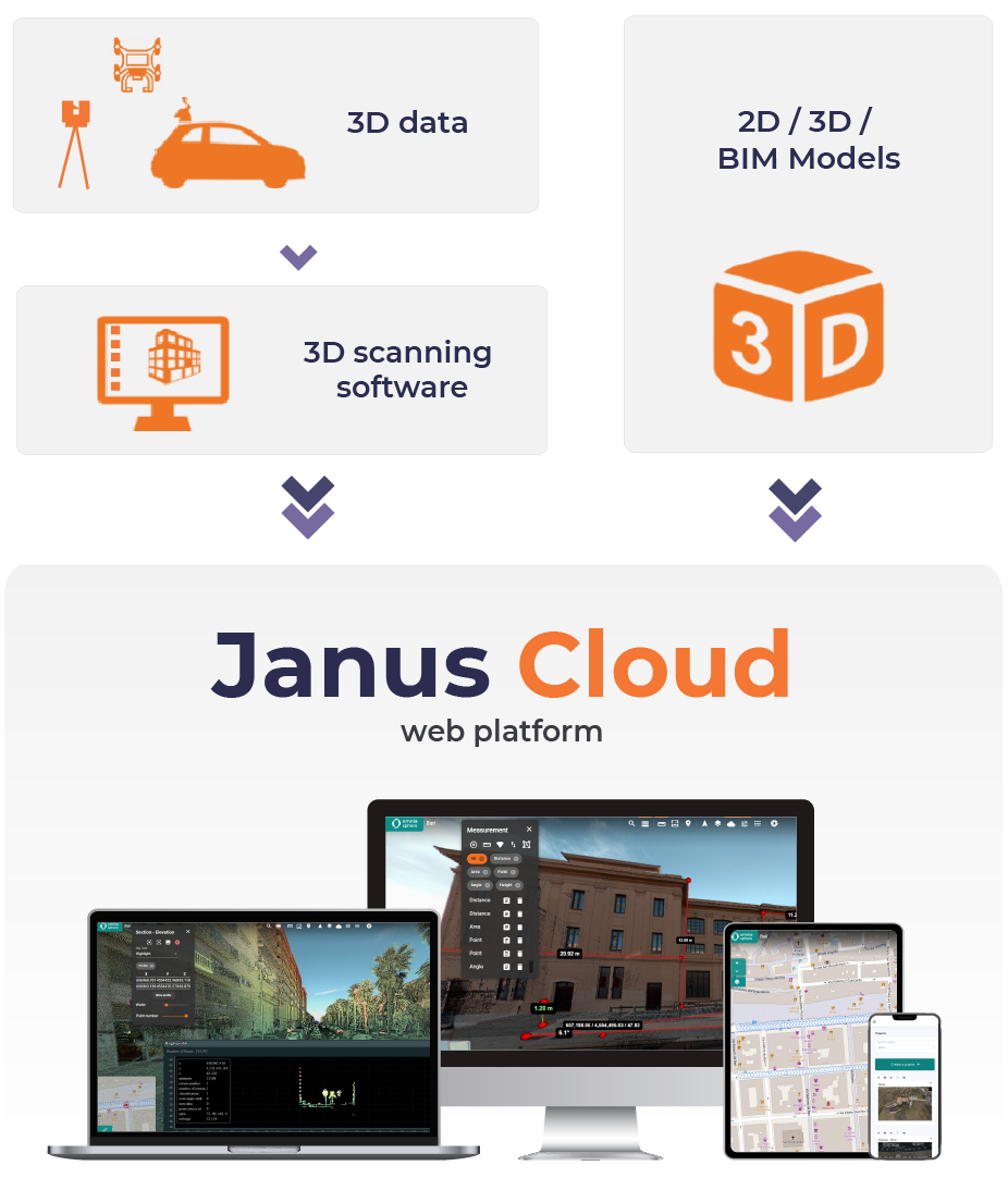
Janus Cloud is the collaborative reference platform that allows you to process, measure, display and share point clouds quickly and easily.
Janus Cloud
Bring your point clouds to life
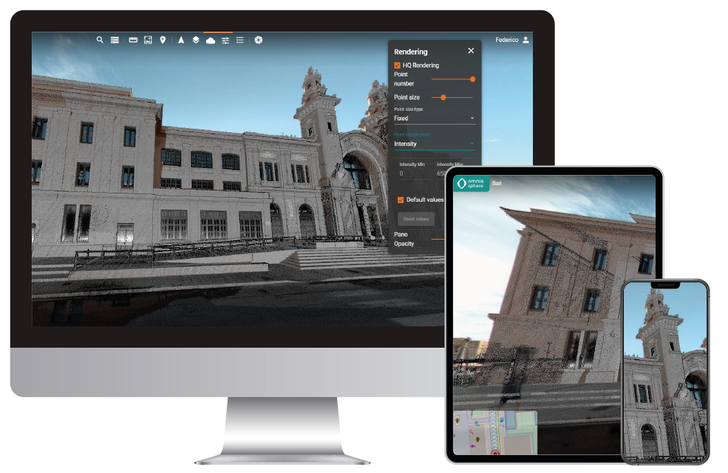
High precision and accuracy
Janus Cloud
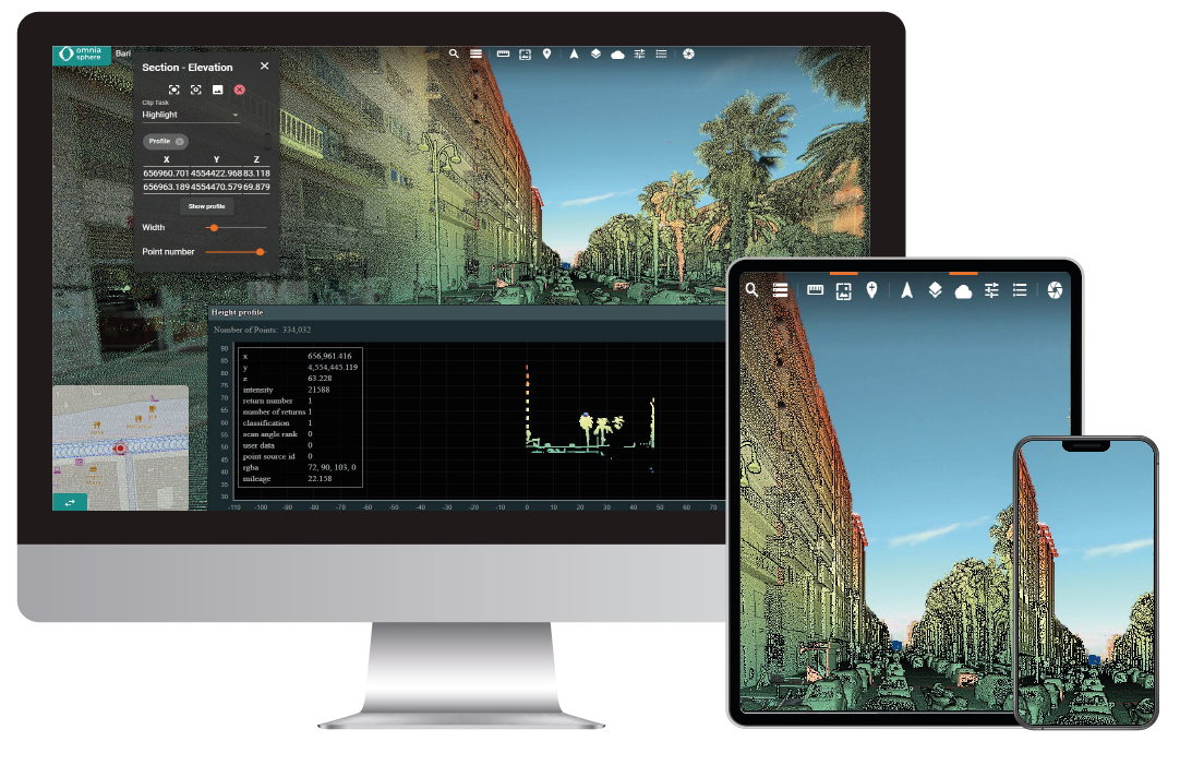
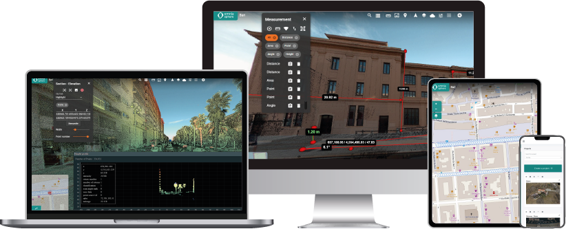
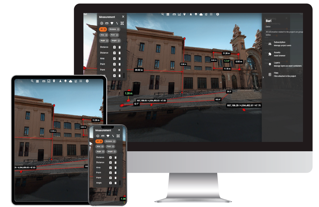
Look how easy it is to import into Janus Cloud any project in high definition from the most popular laser scanners. Explore your surveys with maximum accuracy. Indeed, you can measure multiple aspects: angles, surfaces, volumes, distances, profiles and heights with a simple click.
Measure every detail
Examine your projects and detect every single aspect: angles, distances, surfaces and volumes.
Advanced sharing tools
Share and customise work with your team through advanced and truly comprehensive permit management.
Compatible and versatile
Janus Cloud supports the most popular point cloud formats of the leading laser scanners on the market.
3D accelerated modelling
The processing of your 3D scans is faster to easily model your BIM models while saving on your budget.
Virtual Reality for work teams
Collaborate in VR on data collected by scanning or aerial photogrammetry with Edgewise, Autodesk Revit, AutoCAD and ArchiCAD.
Simultaneous and shared visualisation
Turn your office meetings into virtual meetings with VR sharing tools.
Janus Cloud
The benefits for the professional
Janus Cloud always with you
Import all point cloud projects to Janus Cloud with one click to have them with you at all times.
Accessibility and versatility
All your projects are accessible from a single online platform from any location and tablet or smartphone device.
Automatic storage
Janus Cloud allows you to automatically save the status of analyses directly on the online platform.
Import of all types of point clouds
Janus Cloud imports all types of sources from mobile scanners, fixed scanners and drones in the most popular .e57, .las, .pts, .ply, .rcp, .rcs formats
Customisable interface
Create the control panel with your logo and company colours for an original and professional interface.
Project video
Janus Cloud allows you to generate point clouds online quickly and easily. Just a few simple clicks and you can even create your own professional video.
Janus Cloud
Teamwork
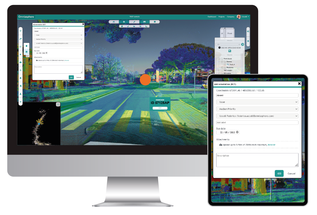
Plan, share and note down every idea.
Share and note
Now it is easy to share your 3D data and work on a single project and note changes and suggestions with all staff.
Organise roles and permissions
Manage and customise user permissions with different configurations and levels of access and display.
Project Versioning
Each project step is automatically saved and made accessible to all group members at all times.
Stay in touch!
Omniasphere GmbH
Hauptstrasse 23
9400 Rorschach (SG)
Switzerland
Omniasphere Srl
Via Fornace, 33
46023 Gonzaga (MN)
Italy