
2D Laser scanner
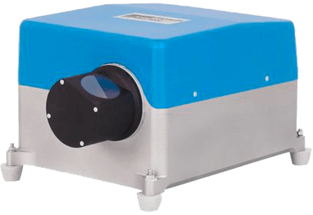
Z+F PROFILER® 9020
The Z+F PROFILER® 9020 2D laser scanner is an extremely efficient device for mobile mapping applications.
Compared to previous models, it has an internal reference plate, very low energy consumption, a very fast start time and a reduction of more than 50% in weight and size.
With the Z+F PROFILER® 9020 and its powerful new laser technology, in addition to its algorithms, you will have extremely accurate measurements on rails, roads, road signs and other traffic control systems such as traffic lights.
The Z+F PROFILER® 9020 can be integrated into different MMS.
It has several ports that allow fast and interference-free communication between its components, the receiver and the PC operator.
The advantages of choosing Z+F PROFILER® 9020
Characteristics
High speed
The Z+F PROFILER #9020 has a rotational speed of 267 Hz or 16,020 rpm max. and measures over 1 million points/sec.
Flexible
With a maximum range of 182 m, the scanner is suitable for almost all mobile mapping applications.
Very high measuring accuracy.
The Z + F PROFILER, 9020, achieves a measurement accuracy of 0.2 mm within a range of 1 m to 25 m.
Smaller and lighter
The Z+F PROFILER® 9020 is up to 50% smaller and lighter than its predecessor, the 9012.
2D Laser scanner Z+F PROFILER® 9020
Technical Data Sheet
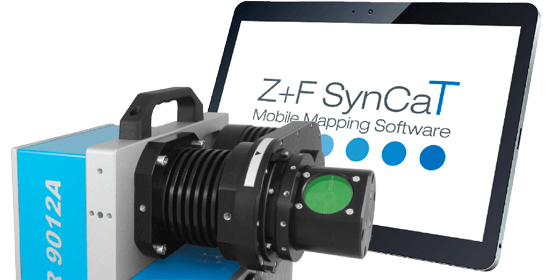
Mobile mapping software Z+F PROFILER® 9020
Z+F SynCaT®
Synchronization, calibration and transformation are the main operations performed by the Z+F SynCaT® software.
Calibration: it will process the calibration parameters due to different system integrations (translation, rotary compensation between the coordinate systems of the navigation unit (trajectory) and the Z+F PROFILER laser scanner 9012).
Synchronization: the Z+F SynCaT® allows the synchronization of the Z+F PROFILER laser scanner data with the 9012 trajectory data and generate 3D cloud point files.
Transformation: enables the transformation of 3D point cloud data from different local coordinate systems and the application of different local/global height correction models (geoid correction files).
Correction: estimation of individual offset with reference to predefined ground control points (GCPs).
Stay in touch!
Hauptstrasse 23
9400 Rorschach (SG)
Switzerland
Omniasphere Srl
Via Fornace, 33
46023 Gonzaga (MN)
Italy